
The Lue Map Treasure
The Lue Map Treasure: still unexplained.
A reputed hoard tied to a hand-drawn Florida treasure chart
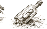
Few real documents have launched more shovels than the Lue Map, a hand-inked Florida chart, passed through the treasure-hunting underground in the mid-century, marking a cache some tie to smuggled bullion. Its provenance is murky and hotly argued, which has stopped exactly no one. It is a genuine artifact of the hunt: a map people still chase, ground people still walk, a riddle still open.
- Where the trail goes cold: The chart's landmarks have been read onto a dozen Central Florida sites; none has yet yielded the cache. That is where any serious search begins.
- What you are chasing is A reputed hoard tied to a hand-drawn Florida treasure chart. Work the documented record of The Lue Map Treasure back to primary sources and separate what is attested from folklore before you commit time or money.
- Confirm who owns and governs Central Florida (per the chart) and get written permission before any search; treat protected or archaeological ground as off limits.
What remains open
- No period map of the site has surfaced.
- No contemporary press coverage has been found.
No documentary claim is yet established. The account rests on tradition.
- No period map of the site has surfaced.
- No contemporary press coverage has been found.
No documentary or visual exhibits have been located yet. The trail below and the open leads are where this dossier grows next — every exhibit that enters here carries a source.
- Where the trail goes cold: The chart's landmarks have been read onto a dozen Central Florida sites; none has yet yielded the cache. That is where any serious search begins.
- What you are chasing is A reputed hoard tied to a hand-drawn Florida treasure chart. Work the documented record of The Lue Map Treasure back to primary sources and separate what is attested from folklore before you commit time or money.
- Confirm who owns and governs Central Florida (per the chart) and get written permission before any search; treat protected or archaeological ground as off limits.
- Search Library of Congress + DPLA (IIIF) for period cartography of the site.
- Run Chronicling America for dated newspaper mentions.
- Query NARA for archival records tied to the site.
Have a source, a map, or a clipping? Add a lead and it enters the record with its citation.
- The Lue Map Treasure · archive record · tertiary · encyclopedia
The full hunt kit
Starting brief, what's known and disputed, evidence timeline, source list, map card, coordinate-confidence and legal-access summaries, and a field checklist, free with a Fellowship account.
Latest Word From the Newswire
Context, not proof. The dossier's own sources remain the evidence record.
Checking the wire…